Import page
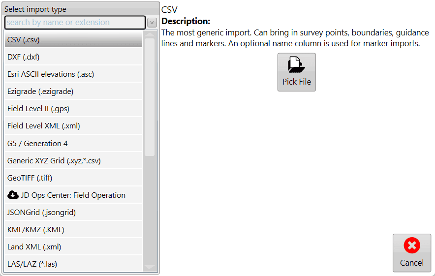
When you have collected your elevation or design data with an external tool, importing is the way to go. You can get here from the Main Page or from the surfacing step in the wizard. When you first open the import page, you'll be presented with a list of import types.
Don't import a TCI file - Load it instead. See Loading Projects for more information.
If you see the one you want, tap it, but you can also search for the import using the text box at the top. Once you've selected your import type, tap the Pick File button on the right and navigate to your file(s).
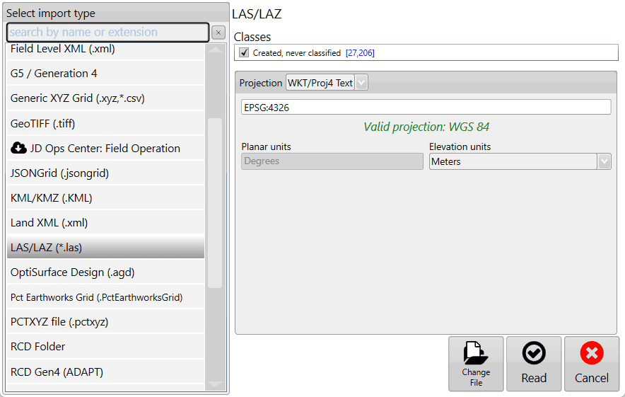
Once you've selected the file(s) to import, if any more information is required, more options will be presented. In this case (LAS/LAZ), it gives you an opportunity to filter point classifications and the projection. If you picked the wrong file, tap Change File, otherwise, tap Read to continue with the import.
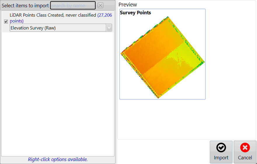
The file(s) are then read and the contents available for import are listed. It's here that you can edit the details about each item found. For surfaces, you can mark them as Elevation or Design, and for points, you can mark them as surveys, drains, linework, markers, or boundaries. Once you're satisfied with your edits, tap Import, and you'll be able to work with your data.