Image Overlays
‘Image overlays’ allows geo-referenced image data to be imported into a field.
The image overlay is accessed by pressing the View button at the top of the screen (Shown right).
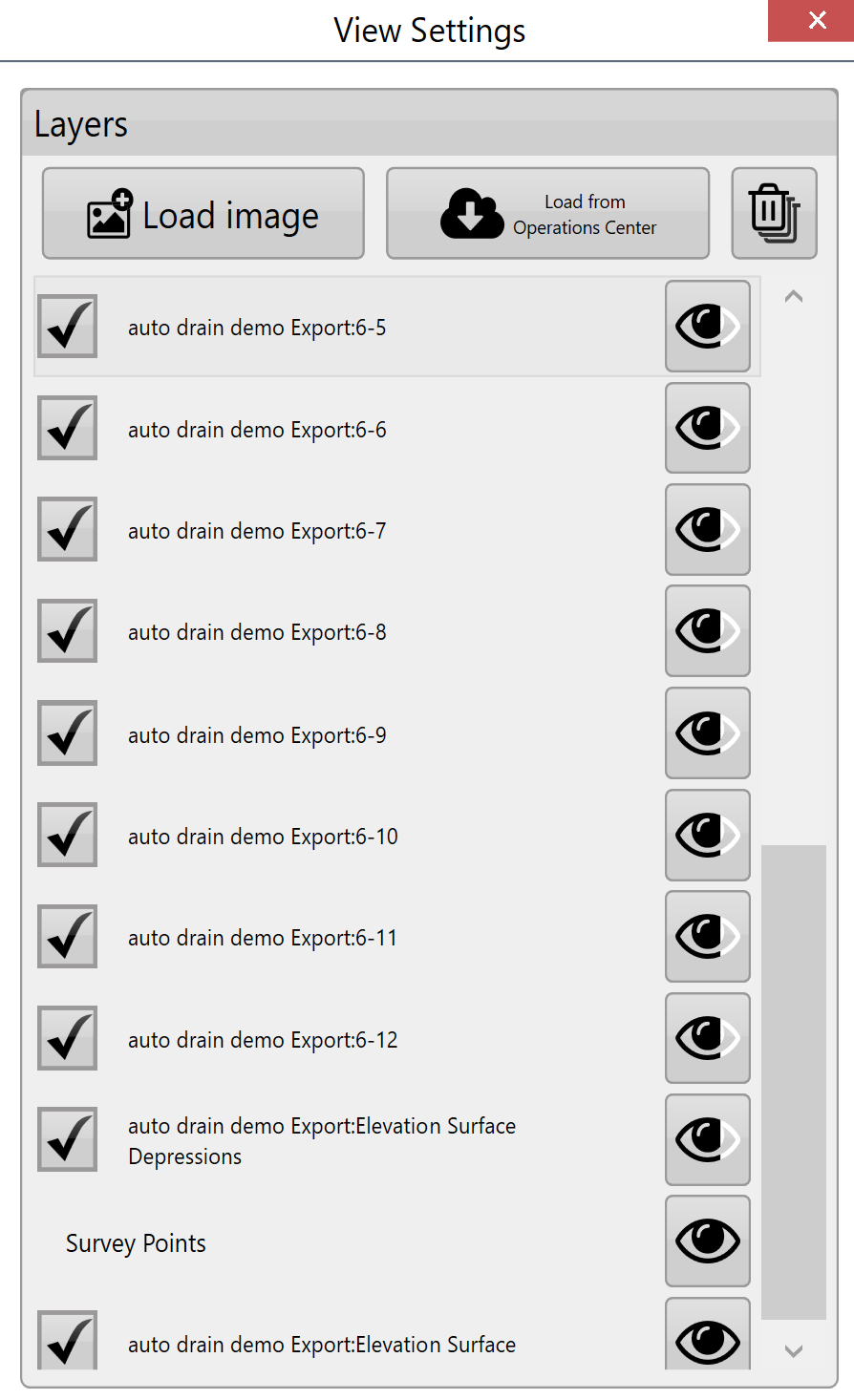
Load image - This is the primary method for adding overlay images to the field. When the button is pressed a file window will open to select the desired file. The file types that are currently supported as overlay images are .KML and .TIFF.
Load image from JDOC - Images from the John Deere Operations Center can be downloaded into the image overlay. This is useful for comparing previous data (such as yields) with current survey data.
Delete images - Overlay images can be deleted by unchecking the box next to them and pressing the ‘delete images’ button. This will delete the layer from the available list.
Transparency - Overlay images can be set to be transparent so that layers below them can be seen. Check the box to the left of the layer and then press the transparency button on the right side.
Layers - Pressing on any of the layers will cause it to be displayed over the others. Drag layers to adjust where they ‘sit’ on the image.