Levee Design
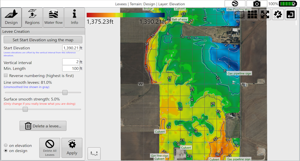
'Levees' allows you to create guidance lines that follow set elevations. They have many names, such as contour lines, level curves, and isoheights. Levees can help reduce erosion, reduce runoff, and promote water capture.
-
Levees can be added at set intervals.
-
Levees can be smoothed.
-
Levees can be selectively deleted.
-
Levees can be applied selectively to field regions.
-
Levees can be exported as guidance curves for use with John Deere AutoTrac™.
Levees can be used to split regions. When doing so, we recommend splitting with a small number of levees. Splitting regions at levees consumes the levees in the process. To create more levees after this, it's recommended to change the elevation or vertical interval to get best results.