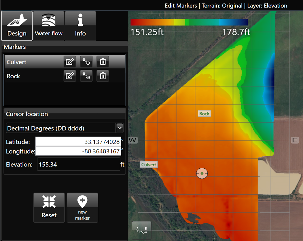
Edit Markers
'Edit Markers' allows you to view, edit, and create markers on the elevation surface. Each marker is listed by name and includes the Latitude/Longitude as well as the elevation. Markers can be moved, renamed, or deleted as desired. Additionally, coordinates and elevation can be entered manually.