Inline Offsets
Inline Offset, also known as Fix Lag, is a surfacing tool that assists in making corrections to elevation data that is imported from other sources.
To access this tool press the ‘Fix Lag’ button located at the left end of the tools at the bottom of the screen. Pressing this button will open a pop-up window that will provide you with the options to correct elevation alignment.

When correcting elevation data In the pop-up window it will be shown on the data behind the window. There are 2 separate sections that control the correction of elevation data in the pop-up window.
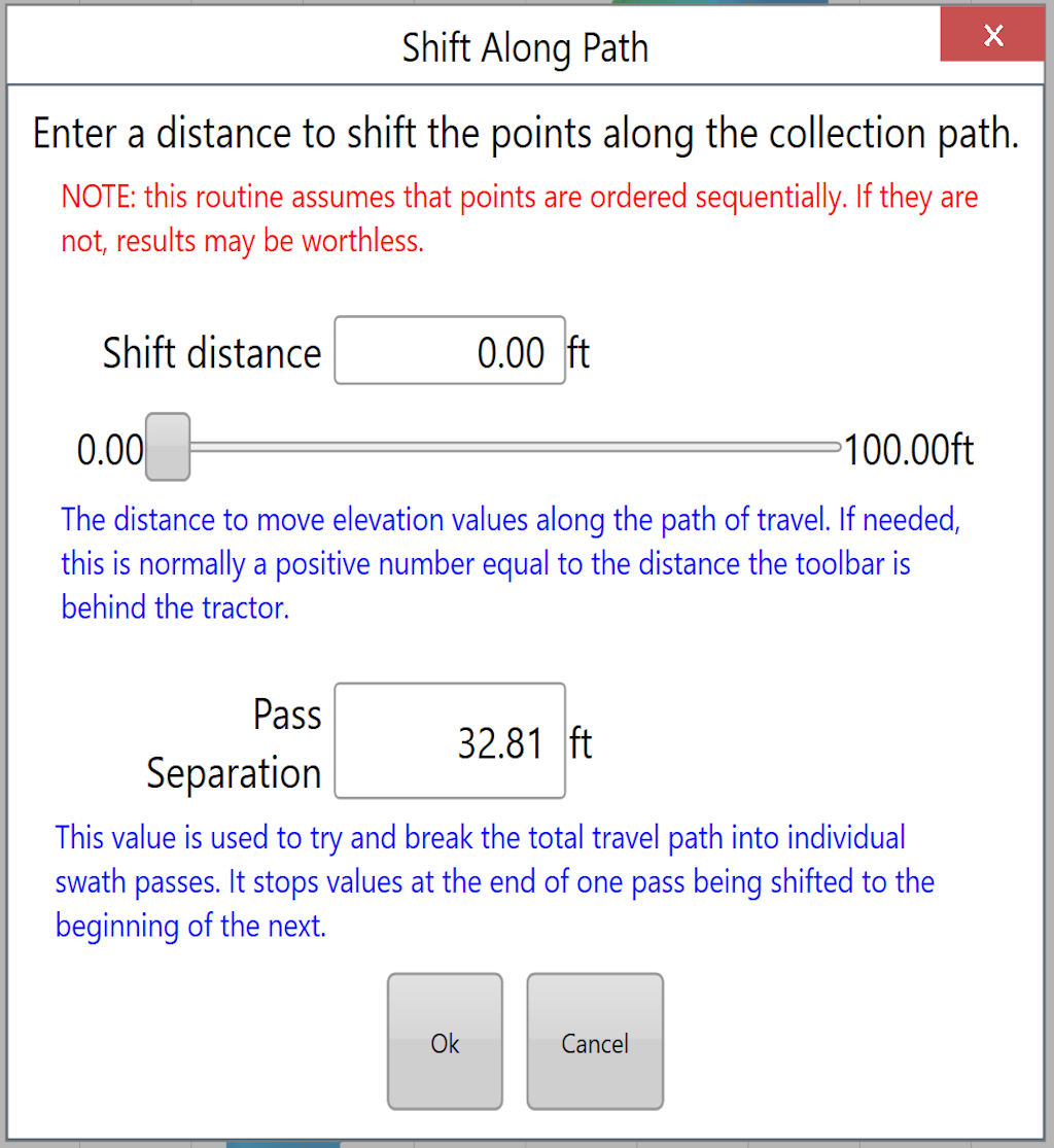
To control how far the data is shifted, move the slider or tap the text box to type in a distance. The slider has a maximum shift distance of 100ft (30m). In the ‘Shift distance’ window you are able to manually set the distance that the data will be shifted, like the slider the maximum value that can be set in the shift distance window is 100ft or 30m.
The lower portion of the window controls the pass separation. Pass separation is how far must be between any point and the next point along before it is considered to be a new segment.
When making changes to the data in the inline offset window they will be reflected on the surface on the map - Check that your change has the desired effect before accepting.