Best-fit Design
'Best-fit' creates a plane of best fit for the field or region. The best-fit calculation produces the slope and direction required to achieve a single plane, while minimizing the amount of dirt moved.
A Best-fit design provides a single plane that most accurately fits the existing topography. Using a Best-fit plane ensures that you move the least amount of dirt possible to create a single plane for a field. Note that this can still result in large amounts of dirt being moved.
Tip: Dividing the field into regions, then fitting single planes to each region can help to decrease dirt volumes.
Enter design details to create a plane, or instruct the T3RRA software to auto-calculate your design details.
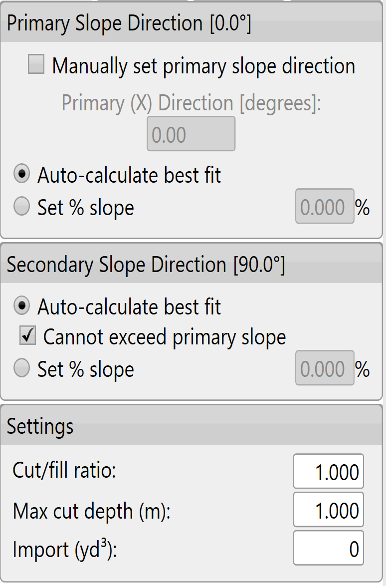
Setting slope parameters
The software will try to find the most appropriate line of best fit, however the primary and secondary slopes can also be manually set.
(It is recommended that only users with a good understanding of Laser Plane systems use manual settings)
To manually set the primary slope direction check the box labeled 'Manually set primary slope direction'.
When in doubt, consult an irrigation engineer.
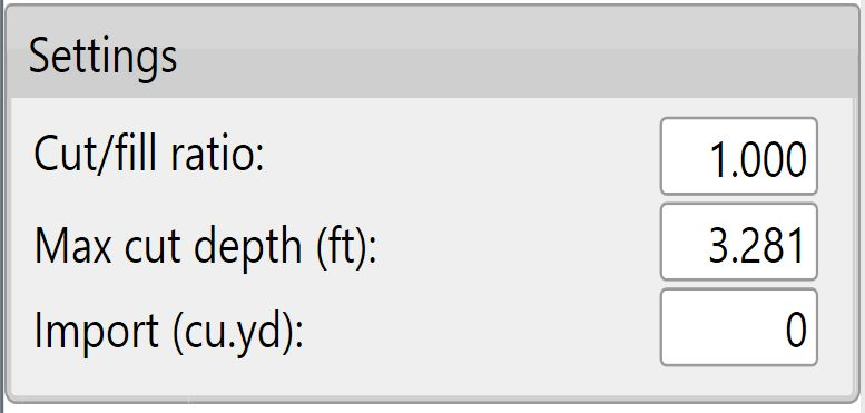
Cut/fill ratio, Max cut depth, & Import can be set in 2 locations. The defaults that will be applied to new projects can be set in the Project tab of settings (see section B) or in the lower left corner of the Best-Fit (and Multi-Fit) page.
The 'Cut/fill ratio' is determined by the type of material being moved and how much of it will “settle” or “shrink” once compacted. This value depends on soil characteristics.
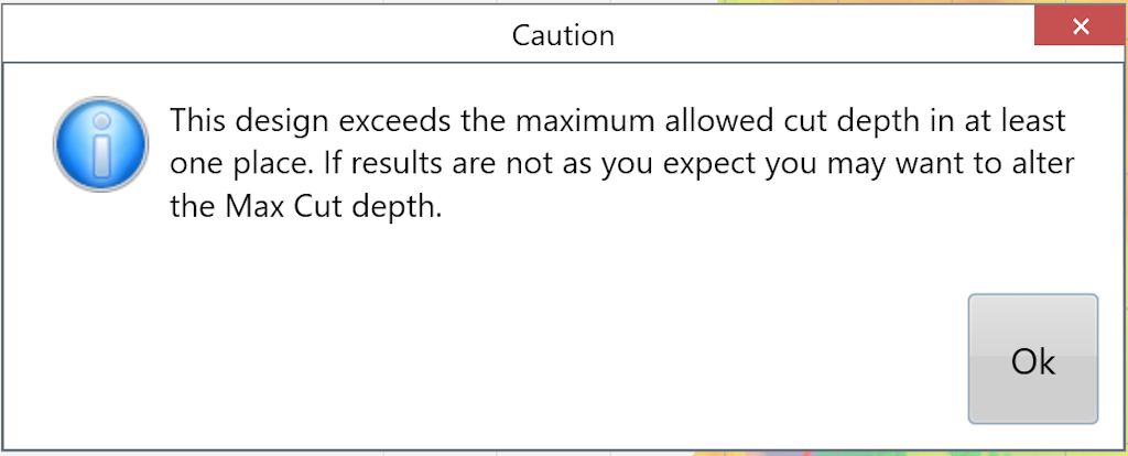
Enter a 'Max cut' for the maximum allowed cut depth. The following warning will appear to notify you if any points on the map exceed the max cut depth. adjustments may be required.
The 'Import' section is used when you need to bring in dirt from a stockpile or export dirt from the field to another area. Change the amount to a negative value for exporting.