Surface profile tool
The Surface profile tool presents a cross-section of the field along the line or path you specify. It samples and plots the elevation of one or two surfaces at evenly spaced points along the line. The distance between samples is specified in meters. It can also calculate slope.
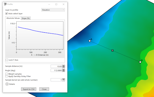
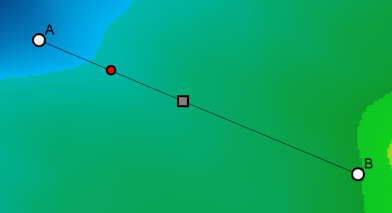
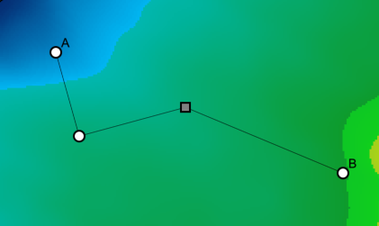
When using the ‘Surface profile tool’, a window will open, displaying a plot of elevation along the sample line. The sample line has three handles that can be dragged to manipulate the line as desired.
More points may be added to the sample line to create a non-linear path by left-clicking on a red node. Red nodes appear when the mouse is in close proximity to a line. The red node will turn white when clicked to show it can be moved to the desired location.
 |  |