Contour lines
 The ‘Contour lines’ tool allows for the automatic creation of contour lines on the selected field. When the tool is selected, the cursor will change into a cross. Left-clicking on the desired field will generate contour lines and open a pop-up window that allows you to make changes to the contour lines.
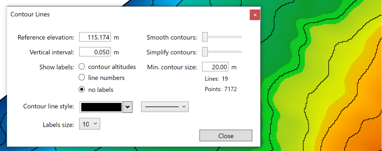
- ‘Reference elevation’ allows you to change the starting elevation that contours fan out from.
- ‘Vertical interval’ is used to change the elevation change between contour lines.
- ‘Smooth contours’. This slider will smooth out sharp turns in the lines. The further to the right the slider is, the more smoothed the contour lines will be.
- ‘Simplify contours’. This slider adjusts how complex the lines are. The further to the right the slider is, the straighter the lines will become.
- ‘Show labels’. On the left is a set of 3 choices: ‘contour altitudes’, ‘line numbers’, and ‘no labels’. These options control the display of information on each contour line. ‘Contour altitudes’ will display the elevation of each contour line. The second choice, ‘line numbers’, will display the number of each line, starting from the reference line. The final choice is ‘no labels’, this choice will leave the lines unlabeled.
- ‘Min. contour size’ is the minimum length of contour lines placed on the field.
- The ‘Contour line size’ options are a set of drop down menus. The left menu lets you select the color of the contour line, and the right menu lets you choose line thickness.
- ‘Label size’ will adjust the size of text along the contour lines.