Show wetness index
 ‘Show Wetness index’ also referred to as the Hillslope Wetness Index. This tool creates a grayscale layer of the surface that uses high contrast to show the most affected areas. Darker areas on the field represent where the most water flow is, while lighter areas show where there is little water flow or where the water moves away from.
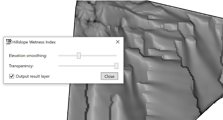
- ‘Elevation smoothing’ slider that averages out the information on the field reducing or increasing the number of peaks and valleys.
- ‘Transparency’ will change how visible the wetness index is.
- ‘Output result layer’ will create a design layer upon closing the tool.