Inline Offset
 'Inline Offset', also known as 'Fix Lag', is a surfacing tool that assists in making corrections to elevation data that is imported from other sources.
To access this tool press the ‘Fix Lag’ button located at the left end of the tools at the bottom of the screen. Pressing this button will open a pop-up window that will provide you with the options to correct elevation alignment.
When correcting elevation data adjustments will be updated in real time on the map.
This will help to make sure that the changes you are making are correct before accepting them. 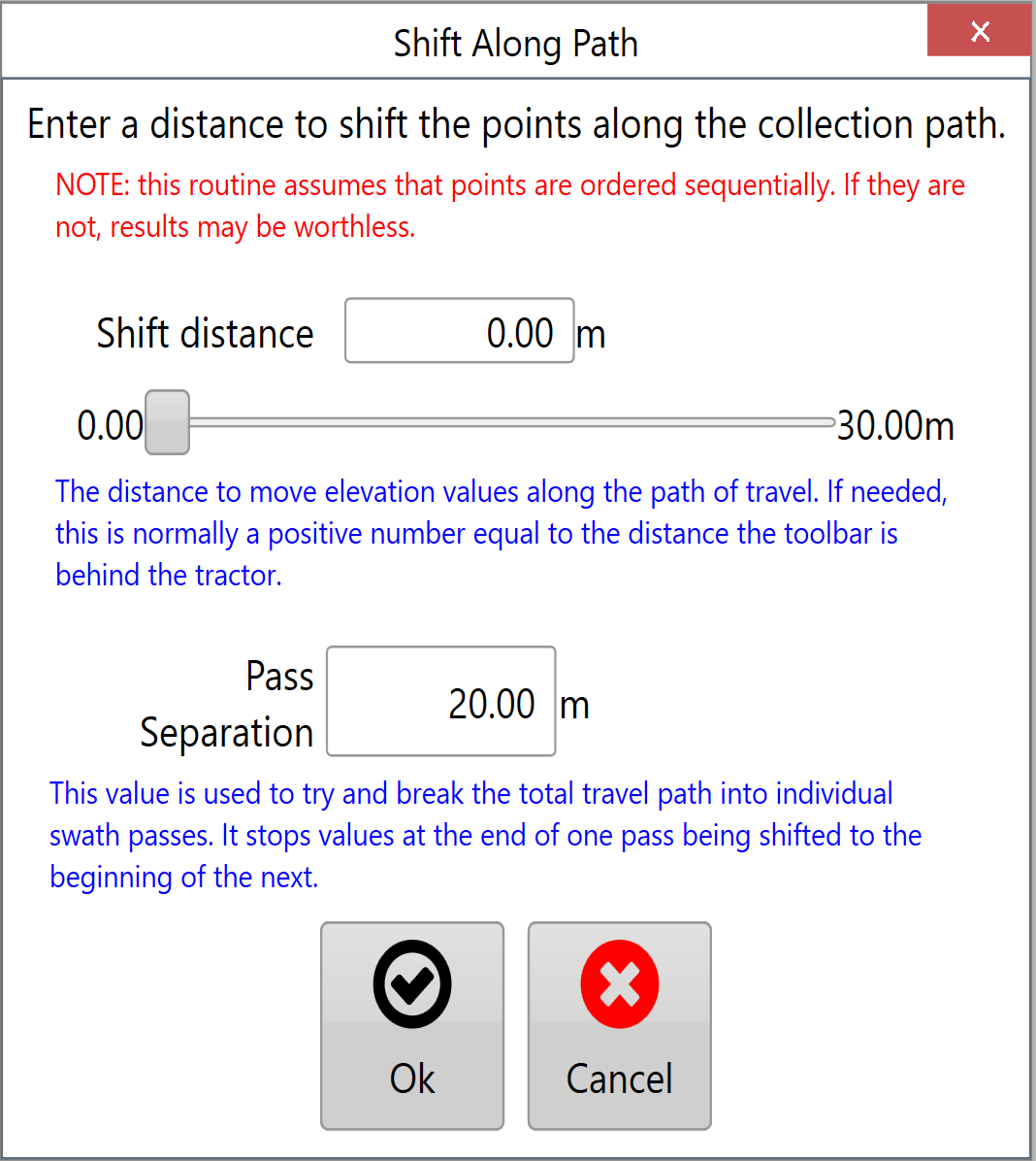 There are 2 settings that control the correction of elevation data.
'Shift distance' moves the data points along the recorded path and can only adjust data to a maximum distance of 30m/100ft. The distance can be manually set or adjusted using the slider.
'Pass Separation' is how far must be between any point and the next point along before it is considered to be a new segment. There is no limit to this distance.
When making changes to the data in the inline offset window they will be reflected on the surface on the map - Check that your change has the desired effect before accepting.