GPS Data
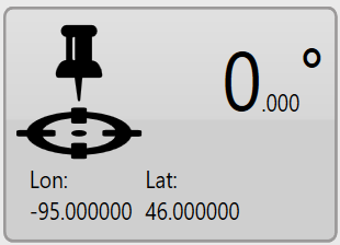
In the lower right corner of the screen is the GPS information button. It displays the latitude and longitude of your current position as well as your current heading.
TIP: Right clicking (press and hold) on this button will reveal a context menu with the option to display coordinates in UTM format.
When you press this button the ‘GPS Info’ window will open with more detailed GPS information.
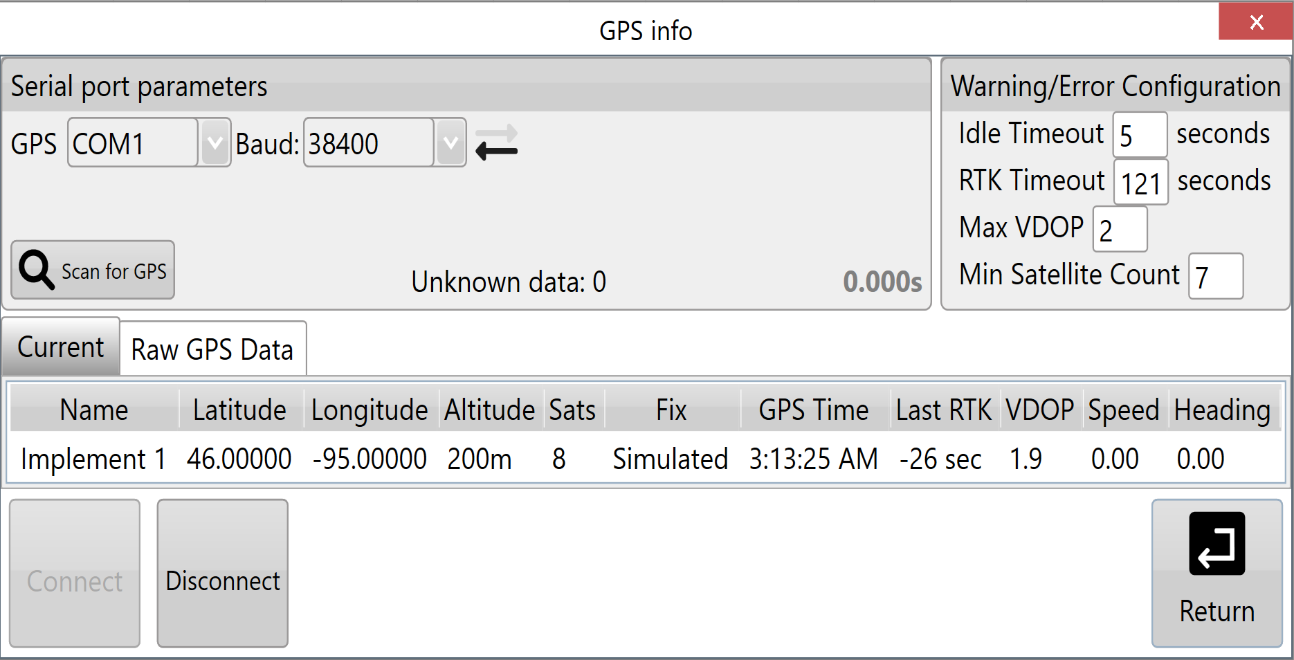
This window provides the following information:
- Serial port parameters: displays the current settings for the com port and baud rate that is being used. There are flashing arrows which indicate that the software is sending and receiving information.
- Warning Thresholds: used to set limits for certain parameters. When these thresholds are being approached the borders of the screen will flash orange, once any of the thresholds have been exceeded or connection to GPS is cut the borders of the screen will flash red.
- Output: shows all the GPS information currently being received.
Serial port parameters
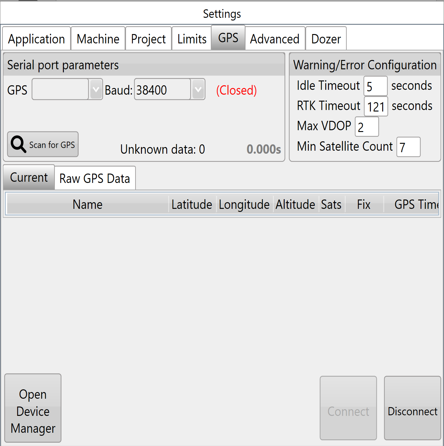
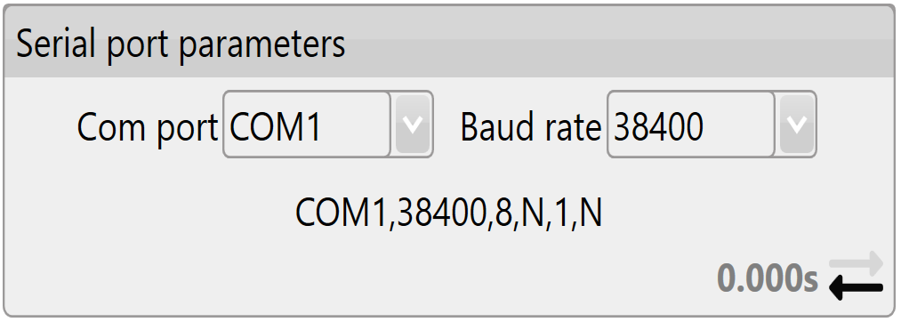 Com port: The Com port # is assigned by the adapter. In the drop down box you can find all available com ports. It is important that this is set to the serial port that is physically attached via cable to the iGrade™ Application Controller. Diagnostic information about current serial ports can be found in the Windows Device Manager. One way of accessing this Windows tool is via the button in bottom left of ‘Settings > GPS’ .
Baud rate: The speed at which the system talks to iGrade™. It is important that this matches the iGrade™ settings or the T3RRA software will not be able to talk to iGrade™. We recommend setting the baud rate to 38400 when connected to iGrade v1. If connected to iGrade™ v2 we recommend setting the baud rate to 115200 with NMEA Message Type set to “All”.
Warning Thresholds
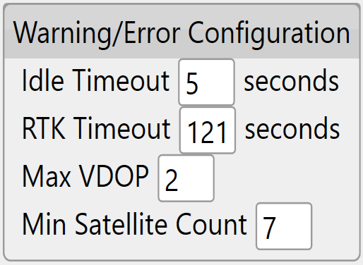 Idle timeout: If no GPS messages have been received in this time period an error warning will show.
RTK Timeout: This monitors the time since the last good RTK correction packet was received. It should not normally be set above 10-20sec.
Max VDOP: Vertical Dilution of Precision is a measure of the altitude accuracy. For the most accurate implementation you will want this value as low as possible however setting lower than 2 may cause interruptions in the use of T3RRA software.
Min Satellite Count: Sets how few satellites the GPS needs to see before a warning is shown.
Output
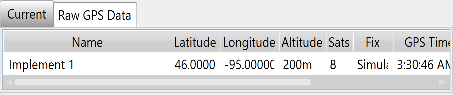
Current & Raw GPS Data: Current displays the current position data for the receiver, while Raw GPS Data will display all the messages that are coming in.
Lat & Lon: Your current location coordinates (latitude and longitude).
Altitude: Your current height (Displayed in chosen measurement format) above sea level.
Num Sats: The number of satellites that your GPS is currently tracking. This is linked to the Min Satellite Count in Warning thresholds and provides an error if this number drops below what is set there.
Fix: The type of position solution calculated.
Time: The current GPS time.
Last Correction: Time since receiving the last differential correction message from the base station. Should be as low as possible for the most accurate readings. It is linked to the RTK Timeout in Warning thresholds and will provide an error if it exceeds that time limit.
VDOP: Vertical Dilution of Precision. If this number exceeds the value in the Max VDOP in warning thresholds it will show an error.